The documents and materials published on this website were collected, researched, and prepared with advice from experts, as a part of a Government-commissioned project. The contents of this website do not reflect the views of the Government. Links to external sites (domains other than https://www.cas.go.jp) are not under the management of this site. For linked websites, please check with the organization/group that manages the website for the link in question.
Commentary on themes by historical period
Classification by historical periods I
After the OYA family and
MURAKAWA family began traveling to Utsuryo Island and Takeshima with permission from the shogunate
(Edo era)
(2) Understanding of Takeshima
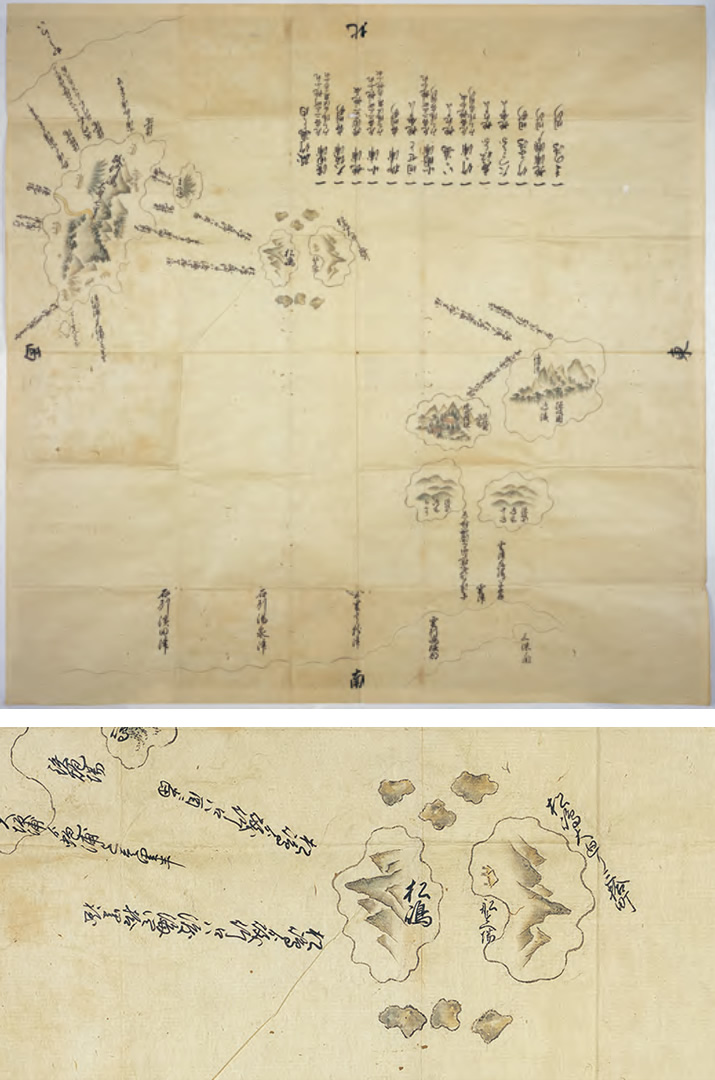
Various documents, including the OYA family’s documents and the records of local history compiled in later years, contained descriptions about how the OYA family and MURAKAWA family stopped off at Takeshima on their passage to Utsuryo Island. These demonstrate that there had been accurate understanding of Takeshima in Japan during the Edo era.
Among the documents of the OYA family, there was a letter addressed to Doki OYA from a merchant
named Soetsu ISHII. According to this letter, if Ichibee MURAKAWA were to shoot sea lions on
Takeshima with a gun, they might possibly flee to Utsuryo Island![]() No.9.
No.9.
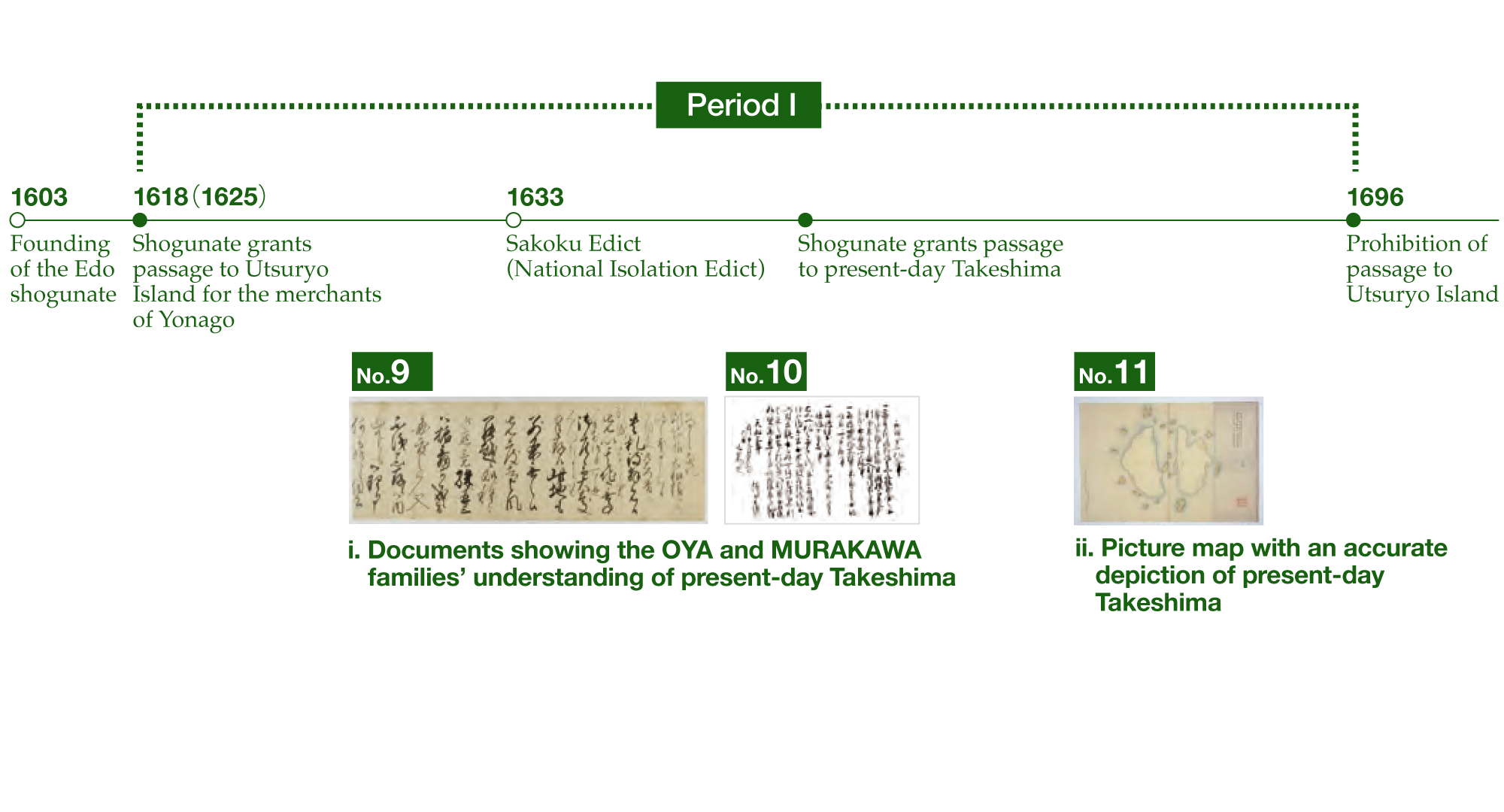
In prohibiting passage to Utsuryo Island in 1696, the Edo shogunate inquired of the Tottori Domain as to the situation on and around the island. For its response, the Tottori Domain prepared a picture map that included Takeshima (known as Matsushima at the time) (shown in the figure on the right). The contents shown in this picture map suggest that they had obtained accurate understanding of the island.
The Map of Matsushima (which was the name of Takeshima during the Edo era) is held in the
repository of the Historiographical Institute of the University of Tokyo. We researched this map
in FY2015. This was a copy made in 1895 based on the picture map produced by the MURAKAWA family
(*1), and it is a rare map in the sense that it is a map focused only on present-day
Takeshima![]() No.11.
No.11.
*1 Takeshima Archives Portal (Reference no.: T1600000000103)
Repository: Tottori Prefectural Museum
Takeshima (shown as Matsushima in the picture map) is depicted as two islands, east and west. The beach of the east island shows the text “Funasueba” (berth) and an illustration of a hut.
Takeshima
Research and Commentary Site
- I Comprehensive issues
- II Commentary on themes by historical period
- III Analysis of claims by other countries