The documents and materials published on this website were collected, researched, and prepared with advice from experts, as a part of a Government-commissioned project. The contents of this website do not reflect the views of the Government. Links to external sites (domains other than https://www.cas.go.jp) are not under the management of this site. For linked websites, please check with the organization/group that manages the website for the link in question.
Analysis of claims by other countries
Column The Ideal Ming Dynasty Coastal Defense and the Senkaku Islands in the Wubei Zhi (Summary)
HIRANO Satoshi (Professor, The University of Tokyo Faculty of Law)
*Adobe Acrobat Reader DC, provided by Adobe, is needed to view the PDF files. If you do not have the software, please download it from the linked site. Adobe Acrobat Reader DC
*Full text is available in PDF.
The Chinese government claims in its white paper titled “Diaoyu Dao, an Inherent Territory of China” released in September 2012 that the Senkaku Islands, known as the Diaoyu Islands in China, and their associated islands are “China's inherent territory in all historical, geographical and legal terms, and China enjoys indisputable sovereignty over Diaoyu Dao.” It also asserts that "In the early years of the Ming Dynasty, China placed Diaoyu Dao under its coastal defense to guard against the invasion of Japanese pirates along its southeast coast." Specifically, the document provides as “evidence” the appearance of the names “Diaoyu Islands” and “Diaoyu” in the following books on the art of war: the Chouhai Tubian (Illustrated book on maritime security) written by Zheng Ruozeng, a staff member to the official Hu Zongxian, who suppressed pirates in the mid-16th century; the Qiankun Yitong Haifang Quantu (Complete map of unified maritime territory for coastal defense) published in 1605, and the Wubei Zhi (Treatise on Armament Technology or Records of Armaments and Military Provisions) written by the military strategist Mao Yuanyi in 1621. However, is that in fact appropriate?
To begin with, in light of Zheng He’s Great Voyages to collect tribute from foreign countries in the early years of the Ming Dynasty, and the existence of the Shun Feng Xiang Song (Voyage with a Tail Wind), a navigation and compass-operating manual in which the place name "Diaoyu Islands" appears, we cannot say that the Ming dynasty lacked ships that could head out to sea. Rather, the Ming decided to permit trade as a boon only to tributary countries that recognized the Ming emperor as the ruler of the Tianxia and implemented a policy of Haijin (ban of maritime activities), whereby private merchants that did not have a relationship with the Ming dynasty were strictly prohibited from engaging in trade.
As a result, private individuals seeking free trade joined forces with Japanese armed mercantile groups, becoming Japanese pirates known as the wokou in Chinese and constantly wreaking havoc along the coastal mainland. Furthermore, the Ming’s weisuo zhi guard-and-battalion system, which was an ordinary regional defense system, exploited low-ranking soldiers severely, and the Ming’s coastal defense fell into a state of crisis. Eventually, the Ming pulled back from the islands along the coast from Zhejiang Province to Fujian Province and Guangdong Province, and there grew a disorderly space where the wokou and private individuals ran rampant, resulting in a partial vacuum in the Ming’s control over the seas. According to the records of accredited envoys sent to Naha to grant the title King of Ryukyu, it is clear that travel between the Ryukyu Kingdom, which ruled present-day Okinawa Prefecture, and the Ming dynasty relied entirely on the knowledge and navigational skills of the Ryukyuans.
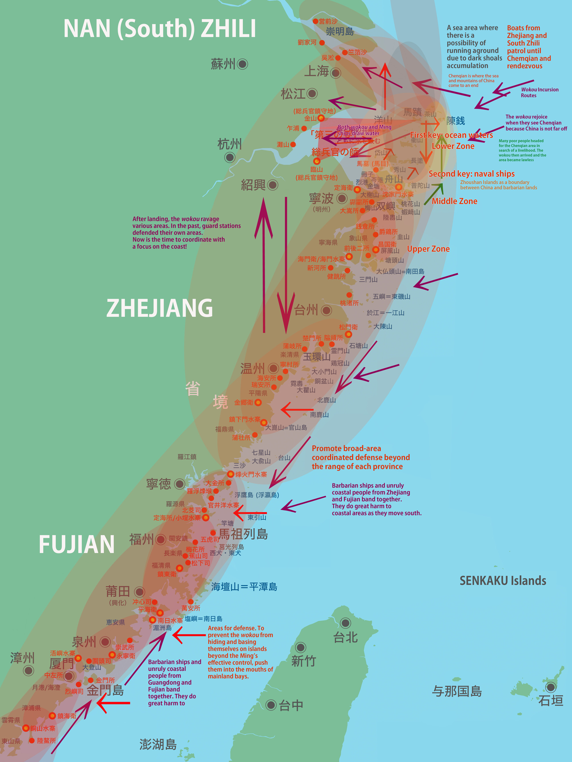
Subsequently, the wokou raids were fortunately brought under control through the efforts of commanders such as Hu Zongxian and Qi Jiguang. The Ming lifted the ban on maritime activities and formally permitted private trade with the countries of the southern seas, and the regional order shifted towards stability through to the late Ming dynasty. However, formal ties with Japan remained severed and ordinary coastal defense remained withdrawn to the mainland coast, so the major issue of how to rebuild an ideal coastal defense system, in preparation for a potential return of the wokou, persisted.
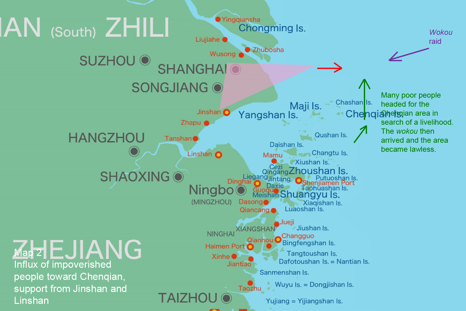
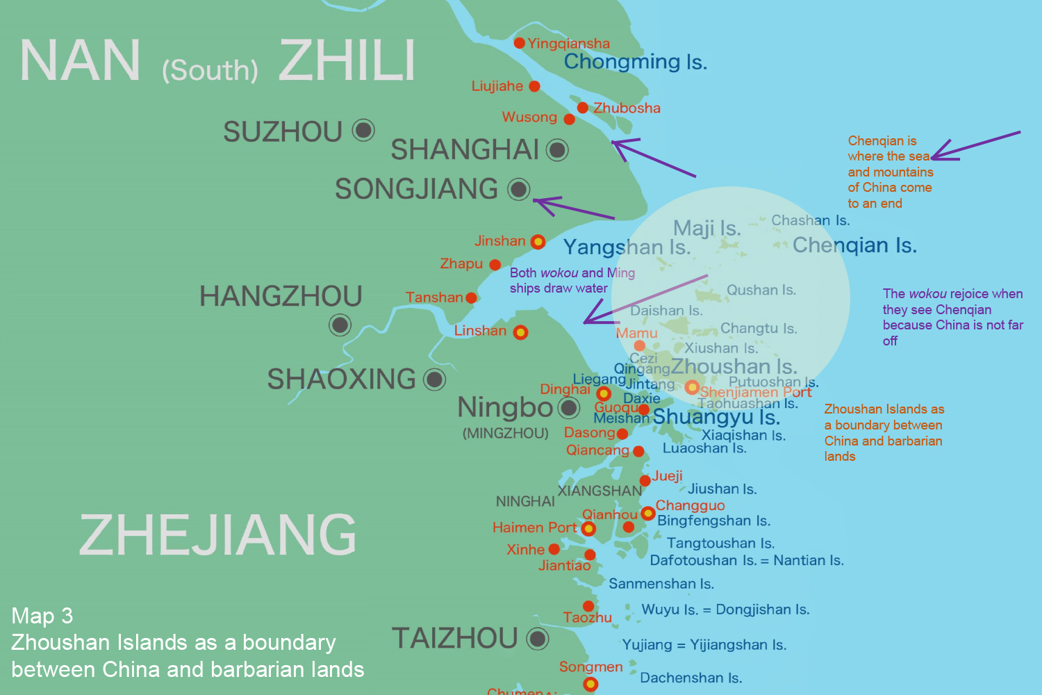
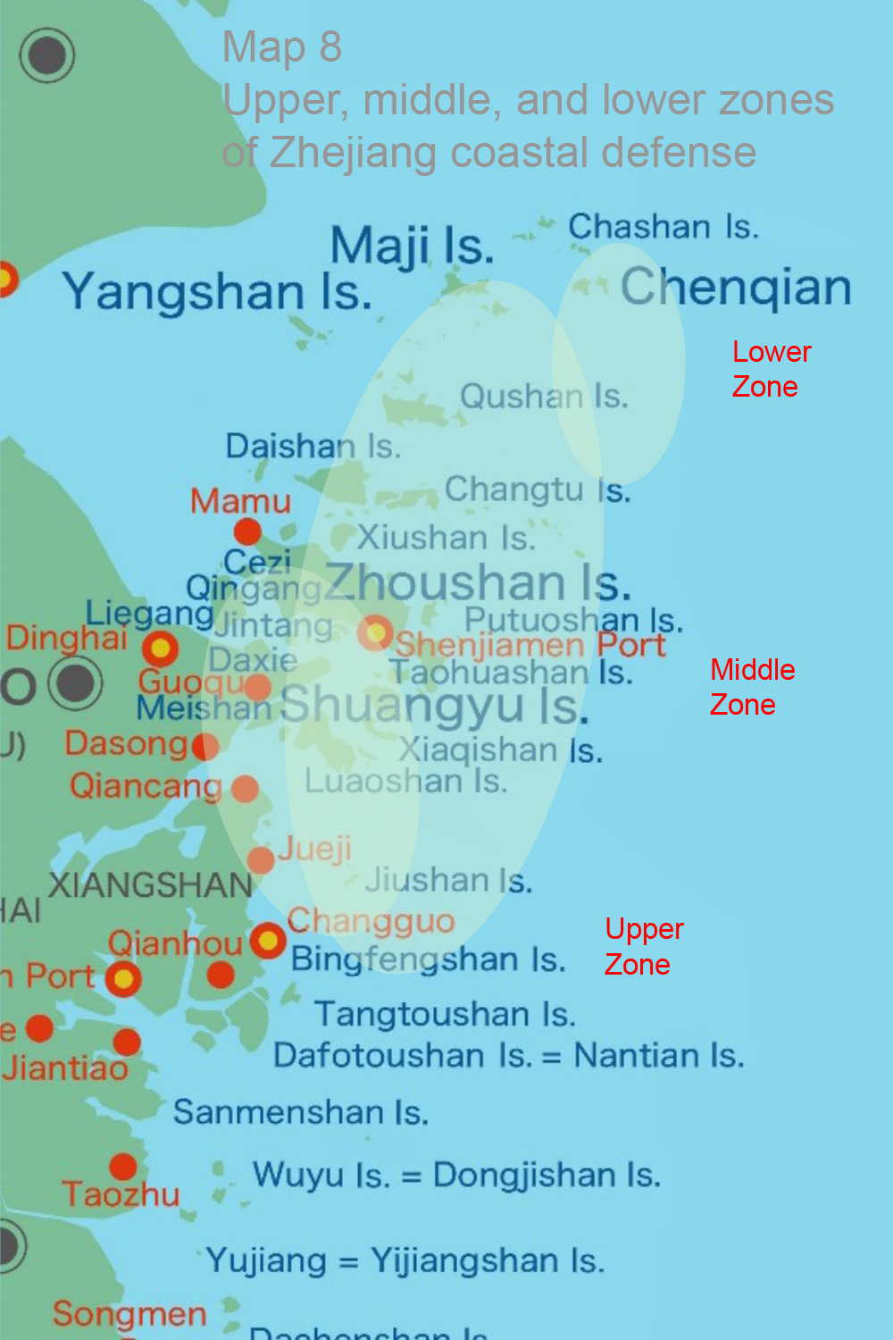
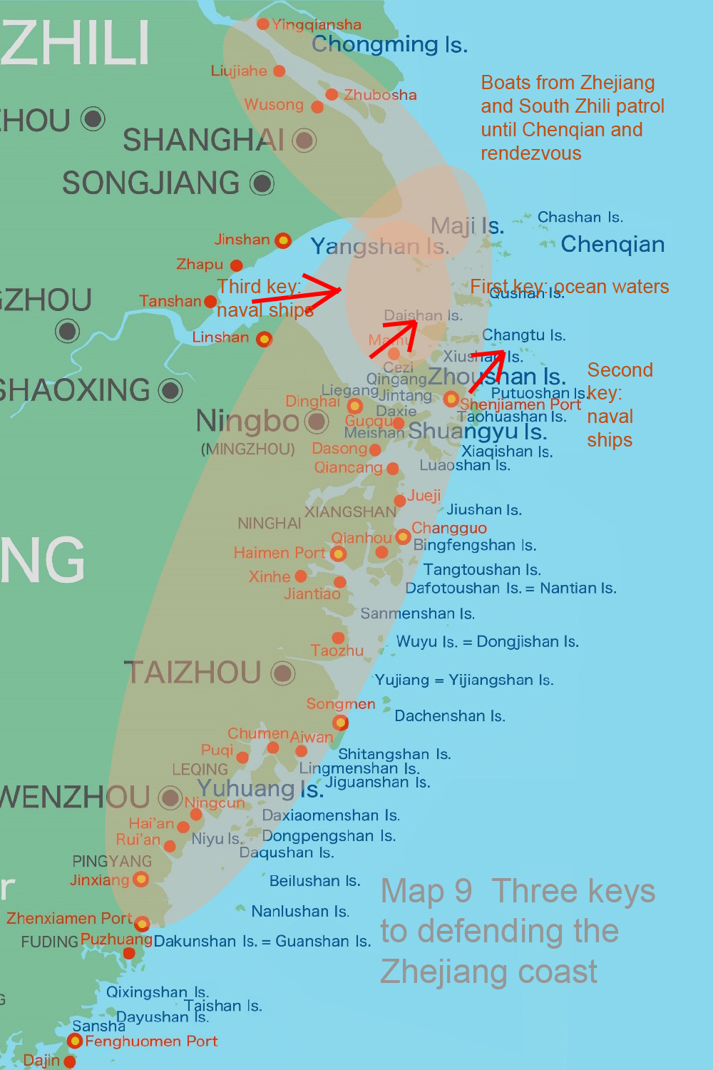
With that in mind, the Wubei Zhi, written in the late Ming dynasty, emphasized the need to first greatly solidify the defenses of the Zhoushan Islands located east of Hangzhou Bay, on the premise that the wokou ride the seasonal winds from the Goto Islands, the Korean Peninsula, and the Yellow Sea to conduct raids. Then, envisaging a scenario in which the wokou were to break through the waters around the Zhoushan Islands, it argued for the rebuilding of the coastal defense system in southern Zhejiang, Fujian and Guangdong as soon as possible, particularly establishing a system for shuizhai (naval ports) and weisuo (garrisons) on the mainland coast, as well as generals and commanders, to be able to coordinate with their counterparts in neighboring regions and provinces, rather than only operating within their own jurisdictions. Then, once the wokou were discovered, they were to be cornered toward the mainland to prevent them from spreading out among the islands and exterminated before landing on the mainland. Moreover, the Wubei Zhi argued that the key to this strategy would be bays and harbors that are shielded from the wind by mountains.
|
|
|
|
|
*Full text is available in PDF. |
|
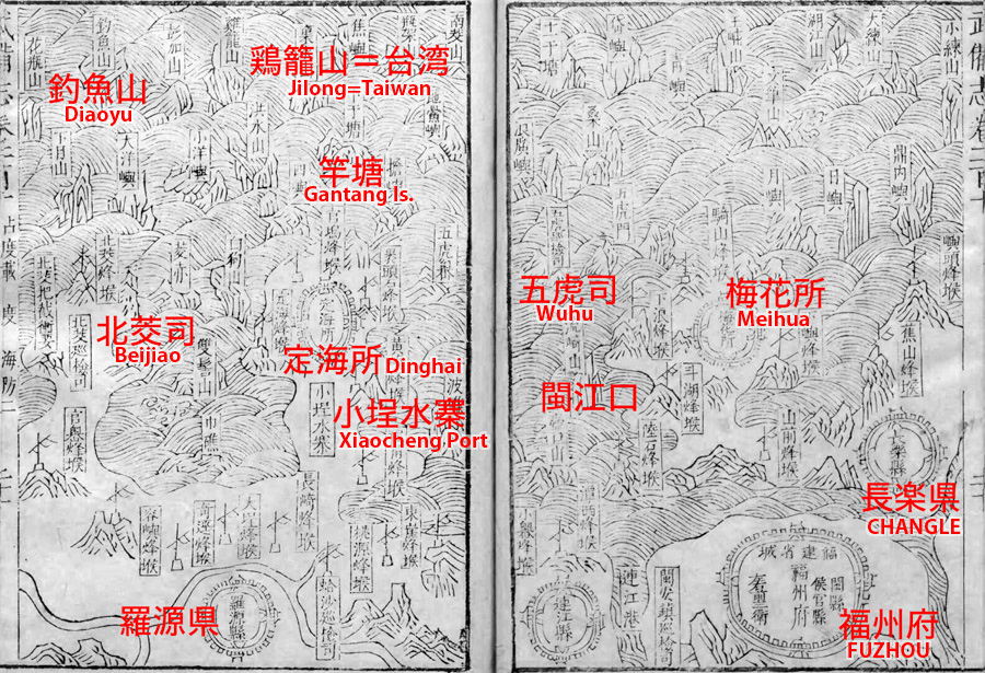
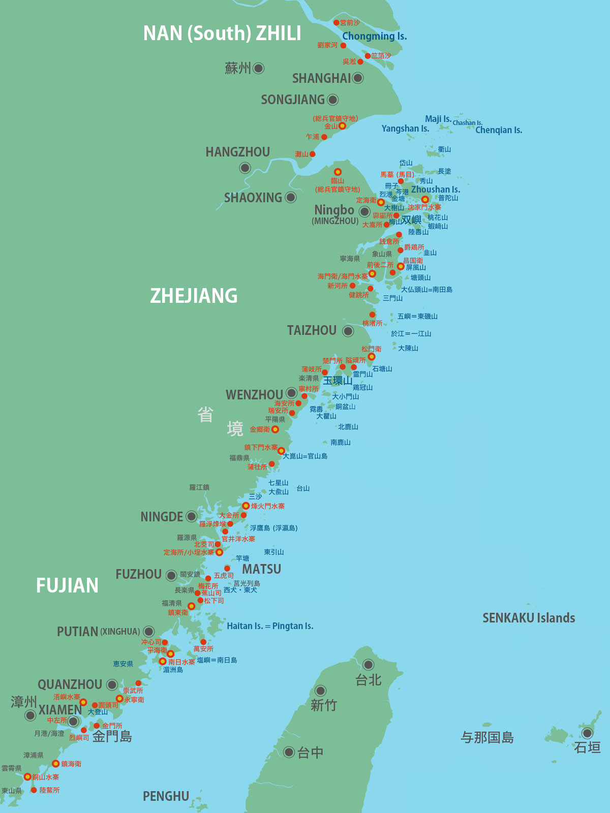
Today's Senkaku Islands and Taiwan, which are far from the mainland, appear on the front of Page 21 of the appendix map "Volume 210: Fujian Coastal Islands Map" with the names "Diaoyu" and "Jilong." However, if one were to look at the appended blank map that incorporates the place and island names used in this book, it is clear that the focus of the book is, in every way, on the Zhoushan Islands and the mainland coast from Zhejiang Province southward. There is no indication at all of the possibility of defending Taiwan or the Senkaku Islands lying far off the coast and further to the east. They are only mentioned in the corners of maps as islands that have long been known to be visible on a voyage out into deep waters, or as the subject of hearsay, for which the idea of ruling them is not considered. Nor are the Senkaku Islands a bay or harbor shielded from the wind by mountains. Therefore, China’s claim ignores the geopolitical ideas that appear in history books and is nothing but an entirely baseless theory that insults the realities of Ming history.
View Full Version (PDF) >
|
|
Senkaku Islands
Research and Commentary Site
- I Comprehensive issues
- II Commentary on themes by historical period
- III Analysis of claims by other countries