(text omitted)
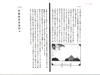
Takeshima is located approximately 85 nautical miles (157km) northwest of Oki in the middle of the Japan Sea. Its name became widely known after the Russo-Japanese War. Takeshima consists of two rocky islands with elevations of a few hundred "shaku." (* Note: one-hundred "shaku" is approximately 30m.) With no trees and no drinking water, Takeshima is surrounded by high steep cliffs. Cold waves wash the bottoms of the cliffs, and there are cave entrances everywhere. The seabed is deep, and it is hard to cast anchor. Together with Kaiba-to (Moneron Island), Takeshima is a place where sea lions breed, and it is very noisy with several thousands of sea lions roaring. Yozaburo NAKAI of Saigo-cho manages "Takeshima Gyoryo Kabushiki-Kaisha" and engages in sea lion hunting.
Content
Industry Guide in Shimane Prefecture
| Related archives |
|---|
| Document title | Industry Guide in Shimane Prefecture |
|---|---|
| Date created (Western calendar) | May 22, 1912 |
| Date created (Japanese era) | May 22, Meiji 45 |
| Author(s) / Editor(s) | Shimane Prefecture Department of the Interior |
| Publisher | Shimane Prefecture Department of the Interior |
| Name of publication | |
| Content | This is a booklet created as tourist guides of Shimane Prefecture after the opening of the San-in railway line between Kyoto and Izumo on March 1, 1912. Takeshima is mentioned in the "City Products and Places of Scenic Beauty and Historic Interest" section, and there is a description of "Takeshima Gyoryo Kabushiki-Kaisha (*Goshi-Kaisha is correct)," which Yozaburo NAKAI was managing. |


