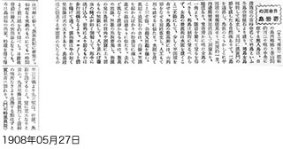
(May 27, Hochi) The uninhabited islands lying mid-way between Saigo Port in Okinoshima and Busan (a distance of about 120 miles) were named Takeshima at the time of the Russo-Japanese War. They consist wholly of craggy rocks, with two larger islands called Oshima ("Male Island") and Meshima ("Female Island") towering opposite each other. Between them lies a natural bridge-like formation resembling an archway that links the islands. Semi-concealed reefs with flat surfaces lie here and there at the base of the islands. The islands have a circumference of about one ri (about 2.44 miles), with steep cliffs rising up on all four sides and subterranean flow. There are caves, tunnels, and smooth blue moss. But even though it should be possible to clamber up the rocks from one corner of Meshima, climbing on Oshima should definitely not be attempted. At its tallest point, Meshima is just over 2 jo (about 6.06m) above sea level, and it has a small amount of flat land. Oshima's highest point is a hexagonal upright rock pillar that looks man-made.
Content
| Document title | A craggy island in the Sea of Japan (Hochi Shimbun) |
|---|---|
| Date created (Western calendar) | May 27, 1908 |
| Date created (Japanese era) | May 27, Meiji 41 |
| Author(s) / Editor(s) | Correspondent Moji |
| Publisher | The Hochi Shimbun (Shimbun Shiryo Shuppan Ltd.) |
| Name of publication | Hochi Shimbun (Morning Edition) (Historical Chronicle of Meiji Period Newspapers, Vol. 13) |
| Content | Introduces the natural environment and fisheries of Takeshima. Now, fishermen from Shimane Prefecture come out to fish between March and September every year, when they make massive catches. After September, the seas are too rough for fishing. |
| Language | Japanese |
|---|---|
| Public access | Open |
| Repository | Shimane Prefectural Library (Japanese Only) |
| Medium | Paper |
| Copies | 1 page |
| Reference No. | T1908052700102 |
| How to access | View at Shimane Prefectural Library. |
| Notes |


