

- Takeshima
Location: 37°9'30" north latitude, 131°55' east longitude, 85 nautical miles northwest of the Oki Islands
Land area: 23 chō 3 tan 3 sebu (approx. 0.231 km²)
Following the recommendation by the Governor of the Oki Islands on May 17, 1905
Content
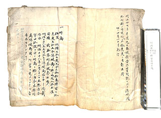
Ledger of State-Owned Land / Takeshima
| Document title | Ledger of State-Owned Land / Takeshima |
|---|---|
| Date created (Western calendar) | May 17, 1905 |
| Date created (Japanese era) | May 17, Meiji 38 |
| Author(s) / Editor(s) | Geographical Section, Shimane Prefecture |
| Publisher | |
| Name of publication | Ledger of State-Owned Land in the Counties of Suki, Ochi, Ama and Chibu, Oki Province |
| Content | Following the recommendation by the Governor of the Oki Islands, Takeshima was added to a Ledger of State-Owned Land in Oki Province. The islands' location and land area are noted, as well as the date of incorporation into the Oki Islands. A note added in August 1940 states that the islands have been requisitioned for use as naval land by the Maizuru Navy District. |
| Language | Japanese |
|---|---|
| Public access | Open |
| Repository | Shimane Prefecture Public Records Center (Japanese Only) |
| Medium | Paper |
| Copies | 1 page |
| Reference No. | T1905051700201 |
| How to access | Follow the licensing procedure at Shimane Prefecture Public Records Center. A reproduction may be viewed in the Takeshima Reference Room. |
| Notes |