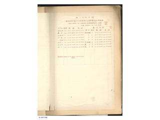
"1908 Chart of the Longitude and Latitude of Utsuryo Island (Ulleungdo), Gangwon Province, Korea, and Takeshima, Oki, Japan"
"Points of Astronomical Surveying: Mejima, Takeshima 37-14-18.462N (actual measurements) and 131-52-22.291E"
Content
"Chart of the Longitude and Latitude Vol. 3" from 1908 to 1913
| Document title | "Chart of the Longitude and Latitude Vol. 3" from 1908 to 1913 |
|---|---|
| Date created (Western calendar) | August, 1908 |
| Date created (Japanese era) | August, Meiji 41 |
| Author(s) / Editor(s) | Hydrographic Department, Imperial Navy |
| Publisher | Hydrographic Department, Imperial Navy |
| Name of publication | |
| Content | Files of records of the longitude and latitude at the points surveyed by the Hydrographic Department from 1908 to 1913. It includes the longitude and latitude of Takeshima surveyed in August 1908. |
| Language | Japanese |
|---|---|
| Public access | Open |
| Repository | Hydrographic and Oceanographic Department |
| Medium | Paper |
| Copies | 2 pages |
| Reference No. | T1908080000201 |
| Reference & Information | Send an inquiry to Japan Coast Guard, Hydrographic and Oceanographic Department (Umi-no-Soudanshitsu) |
| Notes |


