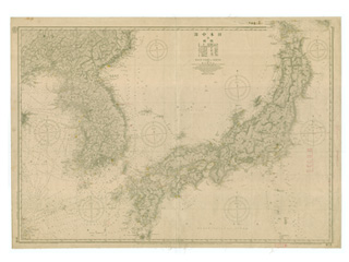
Takeshima (Liancourt R.) and Utsuryō Tō (Island) (Ulleungdo) (also called Matsushima at that time)
*Liancourt Rocks: "Lyanko Islands"
"Lyanko Islands" was the Japanese colloquial term for Takeshima derived from "Liancourt Islands," the Western name given to Takeshima. Due to charting errors by European explores, Utsuryo Island was also called "Matsushima," and the present Takeshima was called the "Lyanko Islands."
Content
Nautical Chart "Main Part of Japan and Korea"
| Document title | Nautical Chart "Main Part of Japan and Korea" |
|---|---|
| Date created (Western calendar) | 1906 |
| Date created (Japanese era) | Meiji 39 |
| Author(s) / Editor(s) | Hydrographic Department, Imperial Navy |
| Publisher | Hydrographic Department, Imperial Navy |
| Name of publication | |
| Content | A nautical chart of the Sea of Japan. Both Takeshima (Liancourt Rocks) and Utsuryo Island (Ulleungdo) (also called Matsushima at that time) are depicted. |
| Language | Japanese |
|---|---|
| Public access | Open |
| Repository | Hydrographic and Oceanographic Department |
| Medium | Paper |
| Copies | 1 page |
| Reference No. | T1906000000101 |
| Reference & Information | Follow the instruction at Hydrographic and Oceanographic Department, Japan Coast Guard |
| Notes |


