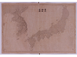
Liancourt Cave (present-day Takeshima), Matsushima (present-day Utsuryo Island (Ulleungdo))
Content
Nautical Chart No. 95 "Comprehensive Map of Japan’s Coasts"
| Document title | Nautical Chart No. 95 "Comprehensive Map of Japan’s Coasts" |
|---|---|
| Date created (Western calendar) | 1878 |
| Date created (Japanese era) | Meiji 11 |
| Author(s) / Editor(s) | Hydrographic Bureau, Imperial Navy |
| Publisher | |
| Name of publication | Map of Japan's Coasts from actual survey |
| Content | A nautical chart created based on the "Ino map". Liancourt Caves (present-day Takeshima) and Matsushima (present-day Utsuryo Island (Ulleungdo)) are mentioned. |
| Language | Japanese |
|---|---|
| Public access | Open |
| Repository | National Archives of Japan |
| Medium | Paper |
| Copies | 3 pages |
| Reference No. | T1878000000101 |
| Reference & Information | Follow the instruction at National Archives of Japan (Or, access the National Archives Digital Archives Website) |
| Notes |


