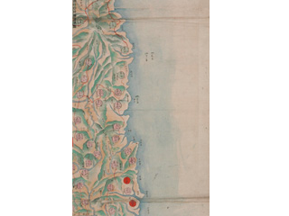
"Uzan Island (Usando)" is located at the west of Uldo (*Utsuryo Island (Ulleungdo)).
Content
Complete Sketch Map of Chōsen (Joseon)
| Document title | Complete Sketch Map of Chōsen (Joseon) |
|---|---|
| Date created (Western calendar) | after 1767 |
| Date created (Japanese era) | after Meiwa 4 |
| Author(s) / Editor(s) | |
| Publisher | |
| Name of publication | |
| Content | Copy of a complete map of Chōsen (Joseon) drawn during the Kingdom of Chōsen (Joseon era). Formerly owned by the Ministry of Foreign Affairs of Japan. Colored copy drawn with brush. Marked with place names and roads in Chōsen (Joseon). Uzan Island (Usando) is located at the west side of Uldo (Utsuryo Island (Ulleungdo)). (From its geographical location, it is clear that Uzan Island (Usando) is not the present-day Takeshima). This contradicts the South Korean claim that Usando is Takeshima. |
| Language | Japanese |
|---|---|
| Public access | Open |
| Repository | National Archives of Japan |
| Medium | Paper |
| Copies | 2 pages |
| Reference No. | T1767000000203 |
| Reference & Information | Follow the instruction at National Archives of Japan |
| Notes |


