History of the determination of territory
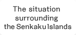
Shouho-okuni-ezu
[Repository] National Museum of Japanese History
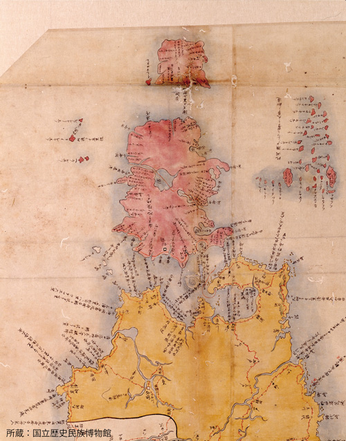
Shouho-okuni-ezu (Partial enlargement)
[Repository] National Museum of Japanese History
1644 –
In the Edo Period, Japan comes to realize the existence of the Four Northern Islands, and gradually establishes control.
Japan came to realize the existence of the Four Northern Islands in the Edo Period. The Edo Shogunate (the government), then ruling Japan, compiled a map of Japan “Shouho-okuni-ezu (Map of Japan from the Shoho Period)”, where appear the names of such islands as “Kunashiri” and “Etohoro (Etorofu).” A number of Japanese sailed to this region. The principali¬¬ty of Matsumae defined the Four Northern Islands as part of its own domain as early as the beginning of 17th century and gradually established control over the Islands.
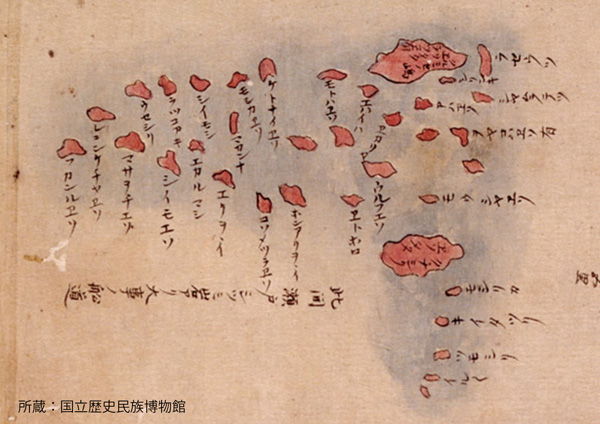
A photo of the marker of Etorofu Island
[Repository] Chishima-Habomai-Kyojusha-Renmei
Thus, Japan already had a close association with the Four Northern Islands before Russia began exploring the Kurile Islands in the early 18th century. As the Shogunate ruled over the Four Northern Islands and placed watching posts on Etorofu Island and other islands to its south in order to prevent the incursion by foreigners no islands to the south of Uruppu Island have ever been under Russian control. In 1798, the Edo Shogunate erected a marker that read “Etorofu, Japan” to display that the island was part of Japan’s territory.
The border based on the Treaty of Commerce, Navigation and Delimitation between Japan and Russia
1855
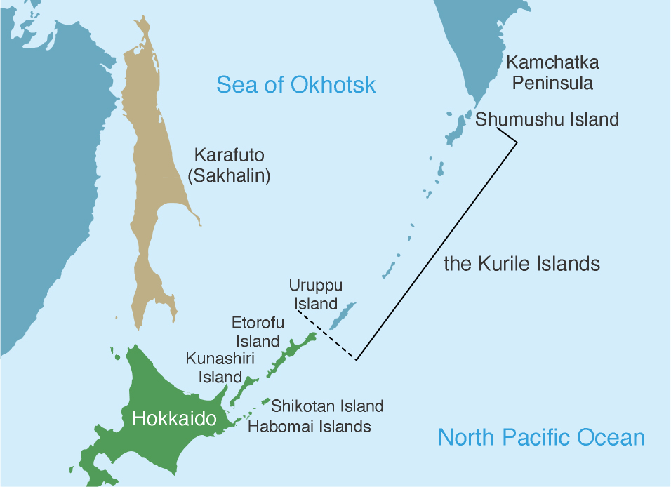
Conclusion of the Treaty of Commerce, Navigation and Delimitation between Japan and Russia: the border between the two countries is determined peacefully to be between Etorofu Island and Uruppu Island.
The Treaty of Commerce, Navigation and Delimitation between Japan and Russia confirmed the border between the two countries as had been naturally formed between Etorofu Island and Uruppu Island. In this way, the two countries achieved agreement in a peaceful and friendly manner.
The border based on the Treaty for the Exchange of Sakhalin for the Kurile Islands
1875
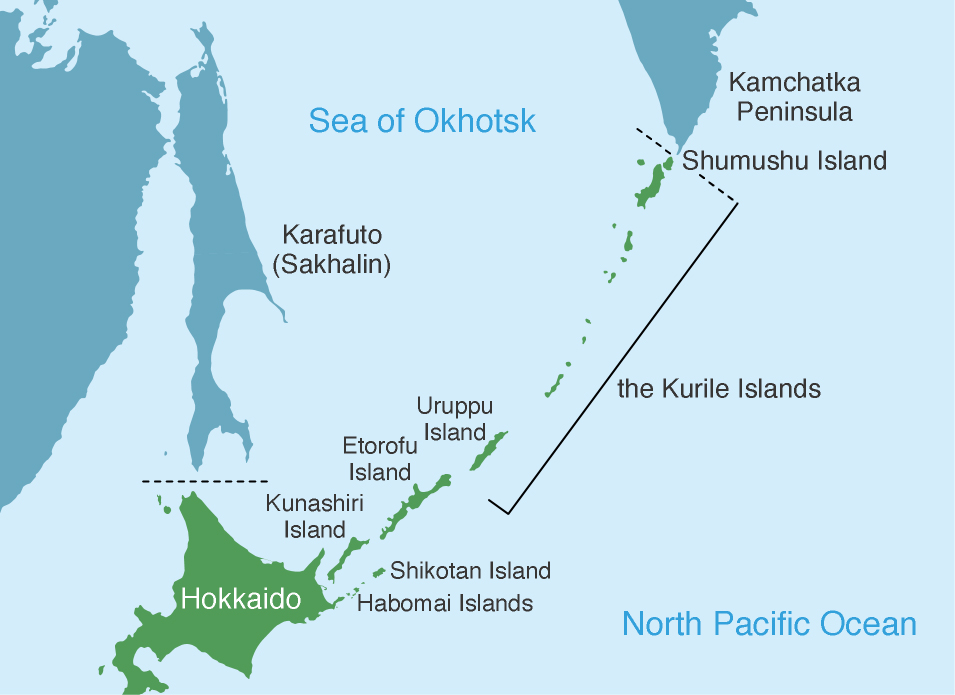
Conclusion of the Treaty for the Exchange of Sakhalin for the Kurile Islands: the Kurile Islands, from Shumushu Island to Uruppu Island, become part of Japan.
As a result of the Treaty for the Exchange of Sakhalin for the Kurile Islands, the rights to the Kurile Islands were ceded from Russia to Japan, in exchange for the cession of the rights to the island of Karafuto (Sakhalin). This treaty enumerated as the Kurile Islands 18 islands from Shumushu Island in the north to Uruppu Island in the south, without reference to the names of the Four Northern Islands (Etorofu Island, Kunashiri Island, Shikotan Island, Habomai Islands). This fact indicates that the Four Northern Islands, being clearly differentiated from the Kurile Islands, have been inherent territories of Japan, which have never been part of a foreign country.
The border based on the Portsmouth Peace Treaty
1905
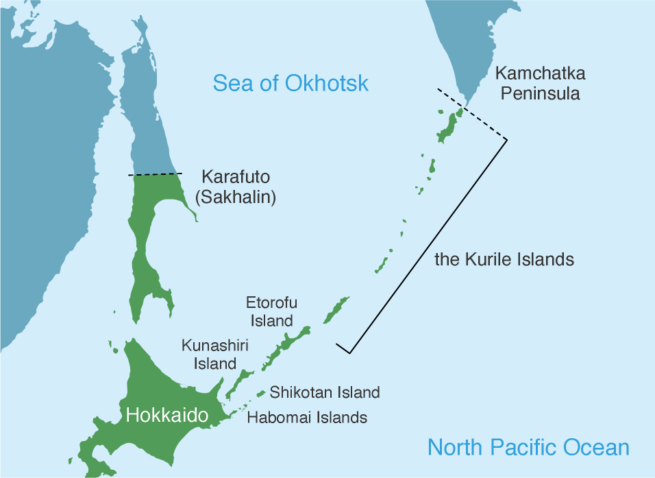
Conclusion of the Portsmouth Peace Treaty : a part of the Karafuto (Sakhalin) Island lying to the south of 50 degrees north latitude is ceded to Japan.
In the Portsmouth Peace Treaty, concluded after the end of the war between Japan and Russia, Russia ceded to Japan a part of Karafuto (Sakhalin) Island lying to the south of 50 degrees north latitude.