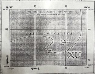
JAPAN 1:250,000 NG51-16 SERIES L506 EDITION1-AMS MIYAKO-JIMA
SEKIBI-SHO. [see PDF]
Content
Topographic maps / Japan / 1: 250,000 Miyako-jima NG 51-16
| Related archives | S1954120000103 |
|---|
| Document title | Topographic maps / Japan / 1: 250,000 Miyako-jima NG 51-16 |
|---|---|
| Date created (Western calendar) | December, 1954 |
| Date created (Japanese era) | December, Showa 29 |
| Author(s) / Editor(s) | US Army Map Service |
| Publisher | Geospatial Information Authority of Japan |
| Name of publication | |
| Content | Map of Miyako-Jima (L506 Series NG51-16) created by AMS (the former US Army Map Service). Taisho Island of the Senkaku Islands is marked on this map. Kuba, Uotsuri, Minami-Kojima and Kita-Kojima Islands are marked on "L506 Series NG51-15 Iriomote-Jima". |
| Language | English |
|---|---|
| Public access | Open |
| Repository | Okinawa Prefectural Archives |
| Medium | Paper/Map |
| Copies | 2 |
| Reference No. | S1954120000203 |
| Reference & information | Follow the instruction at the Okinawa Prefectural Archives |
| Notes |

