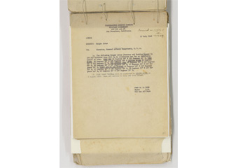
27 July 1948
SUBJECT: Danger Areas
To: Director, General Affairs Department, O.C.A.
1.The following Danger Areas (Gunnery and Bombing Ranges in 1st Air Division Area will be in continuous use for an indefinite period of time. KOBI SHO 25 Degrees 56' N 123 Degrees 41' E, TORI SHIMA 26 Degrees 36' N 126 Degrees 50' E IRISIMA SHIMA 26 Degrees 23' N 127 Degrees 0' E,
(text omitted)
FRED M. LA BREE
Major C.E.
Dir Gen Aff Dept
Content
Danger Areas
| Related archives |
|---|
| Document title | Danger Areas |
|---|---|
| Date created (Western calendar) | July 27, 1948 |
| Date created (Japanese era) | July 27, Showa 23 |
| Author(s) / Editor(s) | FRED M. LA BREE Major C.E. Dir Gen Aff Dept/HEADQUARTERS RYUKYUS COMMAND MILITARY GOVERNMENT |
| Publisher | Document Section, Liaison and Public Affairs Division, General Affairs Bureau, Government of the Ryukyu Islands |
| Name of publication | 1948 (1-2) Correspondence with the U.S. Civil Administration / documents received |
| Content | Notice of the indefinite use of five danger areas including Kobi-Sho (Kuba Island of the Senkaku Islands). |


