
2 Area
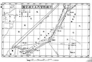
Okinawa Prefecture, in the southwest of Japan, faces the Pacific Ocean on the east and the East China Sea on the west, and comprises more than 60 islands of varying sizes. These are divided into the Okinawa Islands, the Miyako Islands, the Yaeyama Islands, the Senkaku Islands and the Daito Islands.
Exercise: Study this Prefecture's area on the map.
10 Politics
The Governor of Okinawa Prefecture is the chief executive of the prefectural administration. Municipal mayors are responsible for administering their respective municipalities. Besides these, Branch Directors are especially appointed in Miyako and Yaeyama to oversee the towns and villages.
The Senkaku Islands belong to Ishigaki Town and the Daito Islands are directly administered by the Prefecture.
Content
Local Geography of Okinawa Prefecture 1933
| Document title | Local Geography of Okinawa Prefecture 1933 |
|---|---|
| Date created (Western calendar) | February 1933 |
| Date created (Japanese era) | February, Showa 8 |
| Author(s) / Editor(s) | Okinawa Prefecture Primary Education Research Group |
| Publisher | Okinawa Prefecture Board of Education |
| Name of publication | Local Geography of Okinawa Prefecture |
| Content | A textbook on local features of Okinawa Prefecture. Okinawa Prefecture comprises more than 60 islands of varying sizes. These are broadly divided into "the Okinawa Islands, the Miyako Islands, the Yaeyama Islands, the Senkaku Islands and the Daito Islands." The Senkaku Islands belong to Ishigaki Town. |
| Language | Japanese |
|---|---|
| Public access | Open |
| Repository | Okinawa Prefectural Archives |
| Medium | Paper |
| Copies | 6 |
| Reference No. | S1933020000103 |
| How to access | Follow the licensing procedure at Okinawa Prefectural Archives. |
| Notes |